
In summary:
- Transform your local area into an adventure map by using satellite imagery to spot visual anomalies and forgotten spaces.
- This practice is more than a hobby; it actively boosts brain neuroplasticity by forcing new patterns of observation.
- Mastering digital reconnaissance—assessing legality, safety, and access from your screen—is the most critical skill.
- Plan short, effective “micro-adventures” by clustering points of interest discovered on the map.
- Always prioritize safety by learning to spot structural risks from an aerial view and carrying essential gear.
There’s a unique kind of restlessness that settles in when your own city feels completely mapped out. The parks are familiar, the streets hold no surprises, and the urge for adventure seems to require a plane ticket. Many will suggest the usual remedies: try a new restaurant, visit a museum. But these are just new destinations on an old map. The real feeling of discovery remains elusive, locked behind the veil of routine.
What if the solution wasn’t to find a new place, but to find a new way of seeing? What if the key to unlocking genuine adventure was already on your screen? The common advice is to “use Google Maps,” but this misses the point entirely. We’re not talking about getting directions. We’re talking about adopting a detective’s mindset, turning the satellite view of your city into a vast, unfolding puzzle.
This guide reframes satellite maps from a simple tool into a cognitive training ground. The true art of urban exploration begins not with a bold first step into an abandoned building, but with the patient, curious act of digital reconnaissance. It’s about learning to spot the subtle clues the landscape offers from above—the overgrown path, the strangely shaped roof, the shadow that doesn’t belong. This is how you rewire your brain for discovery.
Together, we will explore the science behind why this kind of novelty is so good for your brain, compare the tools for adventure, and cover the essential, non-negotiable rules of safety and legality. You will learn to plan an entire micro-expedition that fits into a single evening and, most importantly, how to document your findings to make them last. It’s time to become an explorer in your own territory.
This article will guide you through the mindset, tools, and safety protocols to transform your perspective. Here is the path your new adventure will take.
Summary: Unlocking Your City’s Secrets with Satellite Maps
- Why Trying a New Activity Boosts Neuroplasticity More Than Routine Exercise?
- Geocaching vs Randonauting: Which App Offers a Better Adventure Experience?
- The Trespassing Laws Every Urban Explorer Must Know Before Entering
- How to Plan a “Micro-Adventure” That Fits Between 5 PM and 9 PM?
- Photography or Journaling: Which Memory Keeping Method Keeps You Present?
- The “Rotten Wood” Test: How to Walk on Abandoned Floors Safely?
- How to Find Silence Near a Major Highway?
- Urbex Safety: How to Explore Abandoned Buildings Without Getting Injured?
Why Trying a New Activity Boosts Neuroplasticity More Than Routine Exercise?
The human brain is an efficiency machine. When you perform a routine activity, like jogging the same path or lifting weights at the gym, your brain activates established neural pathways. It’s effective for physical conditioning but offers limited cognitive challenge. True mental growth thrives on novelty. Neuroplasticity, the brain’s ability to form and reorganize synaptic connections, is supercharged not by repetition, but by tackling unfamiliar problems. This is where the art of satellite map exploration comes into play.
Scanning an aerial map for “pattern anomalies” is a powerful cognitive workout. You’re not just looking; you’re actively searching for breaks in the expected visual rhythm: an unnaturally straight line in a forest suggesting an old railway, a patch of chaotic vegetation in a neat industrial park, or a roof with a texture that indicates decay. This act of digital reconnaissance forces your brain to build new connections, engaging its problem-solving and pattern-recognition centers in a way no treadmill can.

As the illustration above suggests, this process mirrors the very structure of our minds. Each potential discovery on the map is like a new, unlit neuron. The mental effort required to investigate it, cross-reference it, and form a hypothesis about what it could be is what creates a new, glowing connection. It’s an adventure that begins in your mind, fundamentally changing how you perceive the world around you long before you ever step outside. This is not just a hobby; it’s a direct exercise in cognitive cartography.
Geocaching vs Randonauting: Which App Offers a Better Adventure Experience?
Once you’re ready to explore, a world of apps promises to guide your adventure. The most popular ones, like Geocaching and Randonautica, offer distinct experiences. Geocaching provides a curated treasure hunt, where you follow GPS coordinates to find hidden containers left by others. Randonautica takes a different approach, using a quantum random number generator to create coordinates based on your “intention,” leading you to unexpected places. Both are fun, but both are fundamentally guided experiences. Someone, or something, is telling you where to go.
True urban exploration, the kind that fosters the detective mindset, is about self-directed investigation. It’s the difference between following a recipe and creating your own dish. Using satellite maps puts you in the role of the investigator, not just the follower. You develop the skills of landscape analysis and pattern recognition yourself. The thrill comes from a discovery that is entirely your own, born from your own curiosity and analytical skill.
The following table breaks down the fundamental differences between these approaches.
| Feature | Geocaching | Randonauting | Satellite Map Exploration |
|---|---|---|---|
| Discovery Type | Curated by others | Algorithm-driven randomness | Self-directed investigation |
| Skill Development | GPS navigation | Intention setting | Pattern recognition & landscape analysis |
| Equipment Needed | GPS/smartphone app | Smartphone app | Computer/tablet with internet |
| Community Aspect | High – shared logbooks | Medium – online reports | Low – independent discovery |
| Learning Curve | Low | Very Low | Medium to High |
Case Study: The Mount Lico Discovery
The ultimate proof of self-directed exploration’s power comes from the scientific community. In 2018, conservation scientist Julian Bayliss made a landmark discovery without leaving his desk. Using Google Earth, he noticed a circular patch of deep green forest atop a mountain in Mozambique that had no roads or paths leading to it. This satellite-based investigation led to an expedition that uncovered the Mount Lico rainforest, an ecosystem completely untouched by modern humans. According to a report on astounding Google Earth discoveries, this hidden world, with its unique species, remained unknown until satellite exploration revealed its existence. It’s a powerful reminder that the greatest secrets aren’t always found through an app.
The Trespassing Laws Every Urban Explorer Must Know Before Entering
The thrill of discovery can be intoxicating, but it must never overshadow the absolute necessity of respecting the law. Urban exploration is about documenting forgotten places, not breaking and entering. The distinction between an accessible, abandoned area and private property is the most critical line an explorer must learn to draw. Making a mistake here can lead to serious legal consequences, turning an adventure into a misdemeanor or felony.
The core principle is simple: you do not have the right to enter a building or fenced-off land without permission. As the community guidelines of one popular platform clearly state, the hobby has a strict code of conduct. The Urbexology platform reminds its users of this crucial rule:
The site is made for ONLY taking PICTURES and in almost all countries you DO NOT HAVE THE RIGHT to enter abandoned buildings without permission
– Urbexology Community Guidelines, Urbexology Platform
Fortunately, your digital reconnaissance on satellite maps is your first and best tool for legal assessment. Before you even think about visiting a site, you can analyze it from above to classify its accessibility. By learning to read the visual cues, you can make a reasonably safe judgment about a location’s status.
Your Action Plan: Three-Tier Access Classification from Satellite View
- Tier 1 – Public/Permissive: Scan for clear indicators of public access. Look for established park pathways, public trails, or areas with absolutely no visible barriers, “No Trespassing” signs, or fencing on the satellite view. These are your safest bets.
- Tier 2 – Ambiguous: Identify properties with unclear boundaries. This includes disused lots with decaying or incomplete fences, unofficial “desire paths” created by foot traffic, or areas where property lines are hard to discern. These require extreme caution and often on-site verification from a public right-of-way. When in doubt, stay out.
- Tier 3 – Clearly Private: Spot any signs of active ownership or recent maintenance. Intact fences, gates, clear “Private Property” signs, parked vehicles, new construction materials, or manicured vegetation are all red flags. These locations are strictly off-limits.
How to Plan a “Micro-Adventure” That Fits Between 5 PM and 9 PM?
The biggest barrier to adventure isn’t money or distance; it’s time. For most urban dwellers, the window for exploration is a narrow slice between the end of the workday and nightfall. The key to a successful “micro-adventure” is not to rush, but to plan with ruthless efficiency. Your satellite map is the ultimate tool for maximizing discovery within this limited four-hour timeframe.
Instead of picking a single, distant destination, the most effective strategy is location clustering. Use your digital reconnaissance skills to identify a small, dense area packed with multiple points of interest. Look for old, disused infrastructure that naturally connects several potential spots, such as a forgotten railway line, a dried-up canal, or an old industrial park with several buildings. By focusing your efforts on a 1-2 kilometer radius, you spend your precious time exploring on foot, not traveling in a car.

This approach turns a simple evening walk into a “micro-expedition.” You can create a route that takes you past three or four pre-identified anomalies, allowing you to perform on-the-ground verification and documentation for each. This maximizes your sense of accomplishment and discovery, even if some spots turn out to be inaccessible or less interesting than they appeared from above.
Case Study: The Evening Urban Exploration Cluster Strategy
Urban explorer James from Yorkshire perfected this method for his after-work adventures. Using Google Maps’ satellite view, he focused on tracing old railway tracks that led out of industrial zones. This simple technique allowed him to identify clusters of abandoned warehouses, signal boxes, and forgotten platforms all within easy walking distance of each other. By planning a route that followed these tracks, he was able to explore three to four unique locations in a single 4-hour evening session, transforming a standard weeknight into a productive expedition.
Photography or Journaling: Which Memory Keeping Method Keeps You Present?
Once you’ve made a discovery, the impulse to capture it is natural. Urban exploration is, at its heart, about documentation. As photographer Jeroen Taal notes, “Urban exploration is not just about thrills—it’s about documenting and preserving the stories of forgotten places.” But the method you choose for documentation can radically alter your experience. The two primary methods, photography and journaling, create a fascinating dynamic: one often pulls you out of the moment, while the other pushes you deeper in.
Photography is fantastic for capturing visual details, but the focus on framing, exposure, and composition can sometimes create a barrier between you and the environment. You experience the place through a lens. Journaling, on the other hand, forces a different kind of observation. To describe a place, you must pay close attention to non-visual sensory details: the smell of damp concrete and rust, the sound of wind through a broken window, the texture of peeling paint under your fingertips. It demands presence.
So which is better? Neither. The most powerful method is a hybrid approach that combines the strengths of both. It turns memory-keeping into a scientific-like process of ground-truthing, directly comparing your pre-visit satellite analysis with your on-the-ground sensory experience.
Your Action Plan: The Split-Page Documentation Method
- Left Page – The Prediction: Before your visit, print a screenshot of the satellite view of your target location and paste it onto the left page of your journal. This is your hypothesis.
- Right Page – The Reality: While on site, use the right page to document the sensory details the satellite could never capture. What are the dominant sounds and smells? What textures stand out? What is the overall feeling of the space?
- Bottom Section – The Discrepancy: Use the bottom of the right page to explicitly note the differences between your satellite prediction and the actual conditions. Was a path more overgrown than expected? Was a building in worse shape?
- Margin Notes – The Metadata: Use the margins to record crucial metadata like timestamps, weather conditions, and your emotional responses at key moments during the exploration. This adds a rich layer of personal context.
The “Rotten Wood” Test: How to Walk on Abandoned Floors Safely?
The most immediate physical danger in any abandoned structure is what lies beneath your feet. A floor that looks solid can be a treacherous trap, weakened by years of water damage and neglect. Your safety assessment begins long before you set foot inside, starting with your analysis of the satellite view. This initial “Rotten Wood Test” is a critical part of your digital reconnaissance.
Water is the number one enemy of structural integrity. From an aerial perspective, you can often spot the tell-tale signs of severe water damage that compromise the floors below. However, you must approach this analysis with a critical caveat. As urban exploration resources often warn, the aerial imagery on mapping services could be several years out of date. A roof that looked intact two years ago might have collapsed last winter. Therefore, use satellite imagery to rule places *out*, not to definitively rule them *in* as safe.
If you see any of the following signs from above, the risk of rotten, unstable floors is extremely high, and the location should likely be avoided. Consider this your first line of defense against a potentially catastrophic fall.
Checklist: Water Damage Pre-Assessment Using Satellite Views
- Identify visible roof holes: Scan the entire roof surface on the highest satellite resolution. Any visible hole, no matter how small, is a direct conduit for water, guaranteeing compromised floors directly below that area.
- Look for dark patches or discoloration: Large, dark, or discolored patches on a roof often indicate where water has pooled or where roofing materials like tiles or shingles are missing. This signifies long-term exposure to the elements.
- Check for collapsed sections: Look for any part of the roof that is sagging, bowed, or has clearly fallen in. This is a sign of catastrophic structural failure, and the rest of the building is likely unstable.
- Spot debris fields around the building: Zoom out and look for debris fields—piles of rubble, wood, and other materials—around the perimeter of the structure. This suggests that parts of the walls or roof have already collapsed.
- Avoid buildings with widespread vegetation on the roof: Trees or large shrubs growing directly on a roof indicate that water has been present long enough to support significant plant life, meaning the underlying structure is almost certainly rotted through.
How to Find Silence Near a Major Highway?
One of the most surprising discoveries an urban explorer can make is not a forgotten building, but a pocket of profound silence in the middle of urban chaos. Finding tranquility near a roaring highway seems impossible, but it can be achieved by moving your analysis from a flat 2D map to a 3D topographical view. The key is to hunt for “sound shadows.”
A sound shadow is an area that is shielded from a noise source by a large physical barrier. While a flat satellite image might show a park right next to a highway, it won’t tell you if there’s a hill or earthen berm between them that could be blocking the sound. This is where tools like Google Earth Pro’s elevation features become invaluable for the advanced explorer.
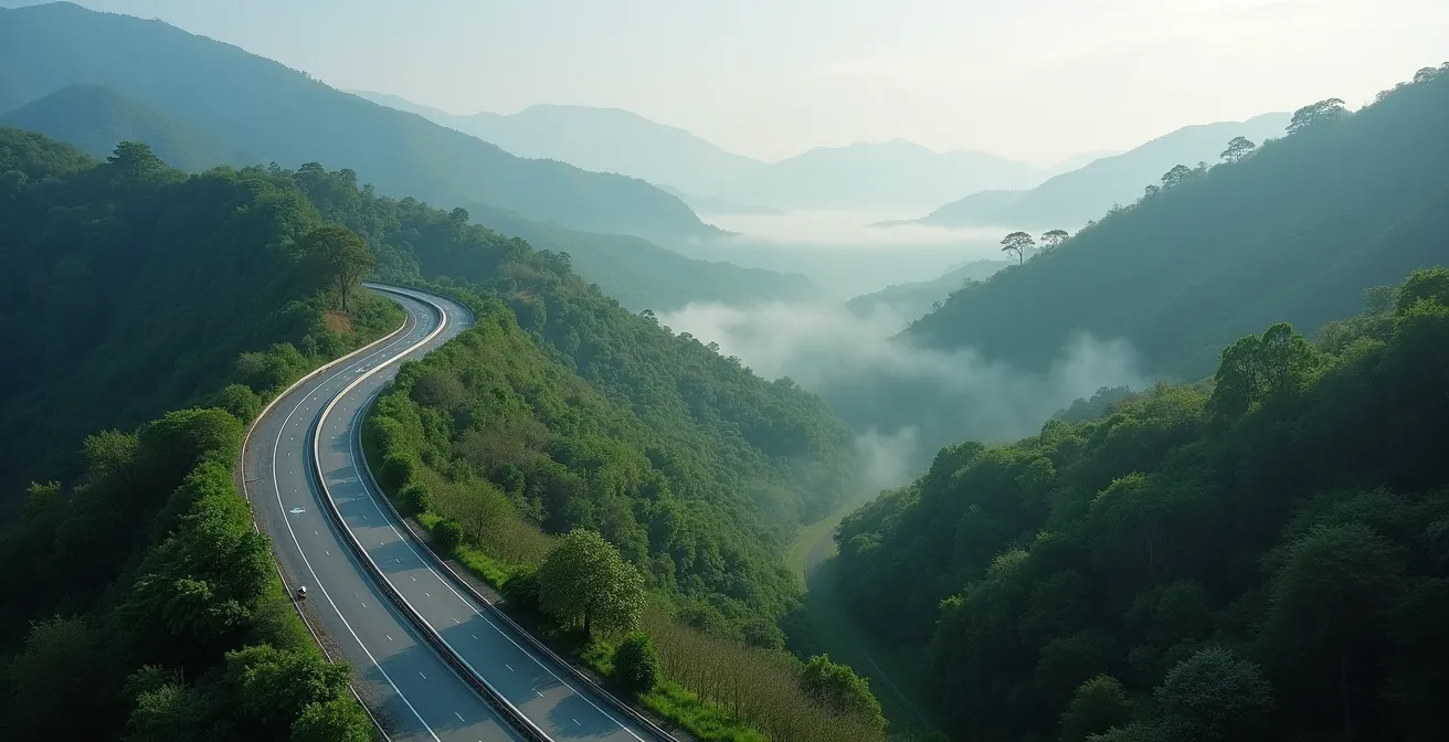
By using these tools, you can identify natural sound barriers that are completely invisible on a standard map view. A small, unassuming hill, a dense stand of trees on a ridge, or the cutting from an old railway can dramatically reduce noise levels, creating an oasis of calm just meters away from the drone of traffic. These are the true hidden gems for contemplative exploration.
Case Study: Using Topographical Layers to Find Sound-Shadow Zones
Google Earth Pro’s elevation profile tool is a game-changer for this type of discovery. By drawing a line-of-sight path from the highway to a potential quiet spot (like a small wood or park), you can instantly see the elevation profile between the two points. If a significant rise in terrain—like a hill or berm—interrupts that line, you’ve found a potential sound shadow. Studies and practical experience show these topographical features can reduce highway noise by 10-15 decibels, enough to transform a roaring environment into one of relative peace, perfect for a quiet escape.
Key Takeaways
- Satellite exploration is a cognitive skill that trains your brain for discovery by focusing on pattern anomalies.
- Safety and legality are paramount. Your digital reconnaissance is your first line of defense to assess risks before you go.
- The most rewarding discoveries are self-directed, not guided by an app’s algorithm.
Urbex Safety: How to Explore Abandoned Buildings Without Getting Injured?
We’ve covered the crucial “before you go” safety checks: assessing legality and structural integrity from satellite views. But your safety protocol doesn’t end there. Once you’ve deemed a location potentially suitable for exploration, on-site preparedness is non-negotiable. Exploring abandoned buildings carries inherent risks, from sharp materials and unstable structures to hazardous air quality. Going in unprepared is not adventurous; it’s reckless.
Your personal safety relies on having the right gear. This isn’t about expensive equipment, but about a few essential, common-sense items that can protect you from the most common injuries. A simple nail–ridden board, a cloud of disturbed dust, or a sudden loss of light can turn an exploration into a medical emergency. The majority of urban explorers are young adults, but enthusiasm is no substitute for caution.
The following checklist, adapted from guidelines by seasoned explorers, outlines the absolute bare minimum of safety gear you should have with you on any exploration. Consider this your “go-bag” for any micro-adventure into a forgotten space.
Checklist: Essential Safety Gear for Urban Exploration
- Heavy-duty boots: Your most important piece of gear. They must have thick soles to protect against upturned nails, broken glass, and sharp metal. Ankle support is also crucial for navigating uneven terrain.
- Durable gloves: Thick work gloves are essential for handling rusty ladders, pushing aside debris, or steadying yourself on contaminated surfaces without risking cuts or exposure to hazardous materials.
- Dust mask or respirator: Abandoned buildings are filled with airborne hazards like mold, asbestos, and “pigeon flu” from bird droppings. A simple N95 dust mask is a minimum; a P100 respirator is better.
- Headlamp with backup batteries: Do not rely on your phone’s flashlight. A powerful headlamp keeps your hands free for climbing and balance. Always carry a spare set of batteries or a backup light source.
- First aid kit: A small, portable kit containing antiseptic wipes, various-sized bandages, gauze, and medical tape is essential for treating the minor cuts and scrapes that are almost inevitable.
- Fully charged mobile phone: Ensure it’s fully charged before you leave. Download offline maps of the area in case you lose signal, and make sure someone knows your exact location and your expected return time.
Now that you have the framework for discovery and safety, the final step is to act. Open a satellite map of your own neighborhood. Look for that strange pattern, that overgrown lot, that forgotten path. Your next adventure is waiting for you to find it, not as a destination, but as a puzzle to be solved.